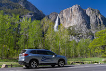
We arrived at the North Rim a couple days in advance of the hike to acclimate ourselves to the 8,500-foot altitude. We rented a nice little cabin and hiked around the North Rim for a couple of days.

On the third day, we were up at 3:30 a.m. getting ready for our 4:30 departure time. The North Rim was a chilly 35 degrees, so dressing in a layer of UnderArmor was a necessity.
Day 1 destination: the Colorado River. We arrived at the trailhead ahead of schedule, about 4:15, said goodbye to our hubbies, and started the journey. Sorry about the lousy picture below. I forgot we already had our headlamps on when Pete took the picture.
The steps are endless and hard on the legs and back. My backpack feels heavier by the minute, slowing my pace and I thank God I have my hiking poles. It's a 6,300-foot drop to the river, and I fear it will be a long day before we get to the river.
Our first water stop is at the Manzanita Rest area, 5.5 miles in; a much-needed rest stop to remove the UnderArmour layer, have a snack, and replenish our water supply. Temps are rising the further we descend into the canyon and are expected to be in the 90s by mid-afternoon.
Manzanita Rest Area
Our next water stop is the Cottonwood Campground, 6.8 miles in and about halfway to the river. We had another snack. filled our camelbacks, drenched myself in water, and continued on. My hiking partner took pity on me and offered to switch packs for a while to give my back a rest. She only had a fanny pack and my back greatly appreciated the reprieve. Just one of the many angels that kept me going on this hike.
We reached the bottom of the Canyon, crisscrossing the Bright Angel Creek a total of 7 times, when a thunderstorm started moving in over us. I was a bit nervous that the storm might be intense, but it turned out to be just a nice passing rain shower to cool us down.
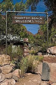
The bottom of the canyon is stunningly beautiful. The trail weaves in and out of side canyons, and you are up close and personal with rocks that are 1.8 billion years old. We finally arrived at Phantom Ranch around 6:30 p.m.
My goal was to cross the Colorado River in the daylight so I could get some good GoPro footage, but it wasn't meant to be. It was still about a mile to the river and it was already dark, so we just pulled up a bench in the amphitheater and rested for a few hours. We had the obligatory Phantom Ranch lemonade (honestly, I don't see what all the hype is about...I've had better lemonade) and then tried to catch a little sleep. It's going to be a long, steep hike up the South Kaibab; 7 1/2 miles from Phantom Ranch, and a 4,700-foot elevation gain.
Day 2 destination: the South Rim. At about midnight, we packed up and headed out. There is no water on the South Kaibab Trail, so we filled our camelbacks and spare water bottles and stocked up as best we could. The water is heavy, and my legs and back are sore, making the going even slower.
We crossed the Colorado River in the dark over a bridge that seemed endless and began the dreaded ascent. We could see a few trail runners coming down the trail up ahead, their headlamps glowing like lightning bugs. I can describe this trail best in 3 words: Steep, Switchbacks, and Stairs. I remember asking my hiking partner at one point how much a helicopter ride up would cost; I did have my credit card with me. She nicely encouraged me to keep going. LOL.
I required frequent rest stops, further slowing the hike. 3 miles up, we finally reach the first rest stop, the Tip-Off. It's still dark out, but it's a welcome place to sit down and take a load off for a bit.
The Tip Off
The most grueling part of the trail was coming; 1 1/2 miles of endless switchbacks and stairs up the canyon wall.
At the 4 1/2 mile mark, we finally reach Skeleton Point. This was the last of the switchbacks and stairs for quite a while, hallelujah! My water was holding out well, but I was tired, sore, and hot, and was thinking I know why it was called Skeleton Point. I just wanted to curl up and die right there. It was time for a snack and a good rest. 3 more miles to the top, I can do this. Unknown to us at the time, our hubbies were at the top of the Canyon at Yaki Point watching us come up the trail and cheering us on. They yelled down into the canyon to us, but the distance was too great and we never heard them.
Onward and upward we go. 6 miles into the hike we reach Cedar Ridge and the trail is getting crowded. With 1 1/2 miles to the top, many hikers use this point for a day hike out and back. There are bathrooms here, but no water. One thing that greatly annoyed me about the bathroom stops is that all of the bathrooms are built up on a hill. So it just adds insult to injury that you have to climb up some more just to use the bathroom.
1 mile to go and we still have to face the final 11 switchbacks at the end to get to the top. We rounded the corner to finally see those switchbacks, and tears of joy literally filled my eyes because I knew we were almost there. This time we did hear our hubbies call out to us, and when we acknowledged that we saw/heard them, they started down the trail to meet up with us. My friend's husband grabbed my pack for me and carried it the rest of the way up, for which I am eternally grateful. 💓
Day 2, 12:30 p.m. 32 hours, 24 1/2 miles, over 87,000 steps according to my FitBit.
Many thanks and gratitude to my hiking partner for her support and patience along the way. I could not have done it without her constant encouragement. I'm sure she could have done this hike easily in one day, as I'm convinced she's part mountain goat! Thank you to the angels sitting on my shoulder and watching over me. I'm sure Jess was one of them. Last but definitely not least, thank you to my hubby for his support and love. I'm sure his worry and stress level for those 2 days were off the charts. Knowing he was waiting for me at the top gave me the fortitude to make it up all those steps and switchbacks.
Would I do it again? Knowing what I know now, I'm thinking about it. We'll see....2026???
Note: all links in this blog are secure and will take you either to our photo albums or to a secure website
If you'd like to read more about our adventures, you can subscribe to our blog in the upper right of this screen. We will never sell your email or send you anything, but you will receive a notice when a new blog is posted.


Comments